|
Virtual Tour of the James Bay
Road
Page 5 of 12
Previous
Next
|
|
|
|
Km 232: Broadback River
Picnic tables, toilets, shelters, fishing. Nice short trail leads
upstream to view the rapids where there are more interpretive signs.
Information panel: "James Bay, the contemporary heir of ice ages".
This is the second of the huge northern rivers that you'll cross.
This also marks the approximate beginning of the prehistoric Tyrell
Sea. And, this is also the approximate southern limit of the Taiga.
Taiga is the word given to the type of forest here: mostly black
spruce and jack pine, with numerous bogs, poor drainage, and small
trees, growing in sandy soil. South of here there are a lot more
deciduous trees (more poplars), and if you are going south, you will
notice a dramatic increase in tree size by the time you reach Km100
or so. Going north you will start to encounter more of the taiga.
However, there isn't a sudden change in the forest type. The change
is gradual and subtle.
This is a good place to stop, get out, and stretch your legs. Please
stay on the trail, as the surrounding vegetation is easily damaged
and takes a long time to recover. |
 |
Broadback River bridge |
|
 |
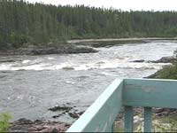
View of the rest area from
the bridge |
|
 |
Looking at the bridge from
the rest area. |
|
 |
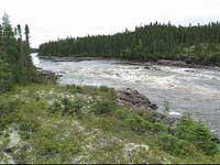
Near the bridge, looking
upstream. The downstream end of the rapids is just
visible. The trail leads to these rapids. |
|
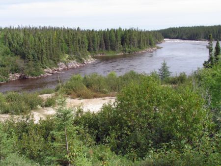 |
Another view of the
Broadback River from the bridge, looking upstream. |
|
 |
Looking downstream from
the bridge. |
|
 |
The trail leading upstream
to the rapids on the Broadback River. |
|
 |
Farther along, the trail
grows smaller. Please stay on the trail to avoid
damaging the delicate ecosystem. |
|
 |
A viewing platform
overlooking the River. There's another one farther
upstream. |
|
 |
Along the trail are a few
interpretive signs (in French only). One of them is
here. It explains that this is the old riverbed of the
Broadback River. |
|
 |
First view of the rapids
through the trees. |
|
|
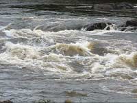
The rapids |
|
 |
| |
|
 |
| |
|
 |
| |
|
 |
| |
|
View movies of these rapids online
(click on the thumbnail photo to view the movie) |
|
|
|
|
|
|
|
|
 |
A kettle lake along the
trail. A kettle lake is a depression left behind by
the glaciers of the last ice age, that fills with water.
This one supports bog species.
|
|
 |
Again, there's an
interpretive sign here to explain this (in French only). |
|
 |
A view of the bridge from
the trail along the Broadback River. |
|
| |
|
Previous
Next |
|
|